Utility Mapping & CCTV Surveys
Underground utility mapping
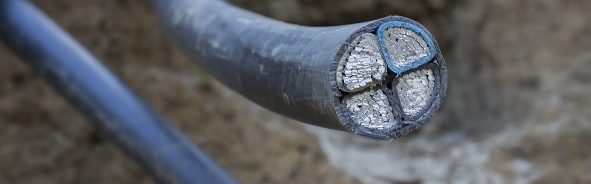
Underground utility mapping is a process of identifying the position of public utility mains that are located underground. The underground mains may include lines for telecommunication, gas, water mains, and electricity.
Underground utility mapping refers to the positioning, detection and the identification of cables that are buried beneath the ground. The mapping handles certain features that are for the most part, invisible to the naked eye. Identifying and detecting underground utilities require specialist equipment and techniques that can’t be obtained via conventional survey equipment.
When using underground utility mapping surveys, we can collect a wide variety of information including the diameter and depths of services, the extents and depths of anomalous areas, we can provide manhole and photo schedules on request and the results from the surveys can also be fed into 3D and BIM software.
Above all, underground utility mapping reduces the risk to those who are digging on the site in question and it minimises any disruption to the general example, for example, damaging water mains.
CCTV Drain Surveys
CCTV survey technology is the most cost effective and most efficient way to inspect sewers and drains. CCTV surveys are used when a drainage problem has been identified, or the client would like to inspect the drain to avoid any drainage problems in the future. The survey is a precise way to get an instant, accurate look at the current condition of underground drains.
To complete a CCTV drainage survey, we use a specialised remote-controlled camera system alongside a software that is specifically designed to survey for CCTV drains surveys. The images that the cameras relay allow our surveyors to assess the condition of the drains or sewer without disrupting the surrounding properties or environments.
Like Topographical Surveys and GPS Surveys, our CCTV Drain Survey and Underground Utility Mapping services are often required by Architects, Building Developers and Engineers who need the specific details of underground features on a specific segment of land.
If you require further information regarding these services, or if you would like to request a quote please don't hesitate to contact us.