
31 Aug
2016
Formby Surveys have invested in UAV technology

Formby Surveys make continual efforts to stay at the forefront of surveying technology by integrating new equipment that will improve our service offering wherever possible. It’s no secret that, in recent years, UAVs (unmanned aerial vehicles) have become incredibly popular, being adopted by aerial photographers to capture impressive video footage of cityscapes, measuring wildlife in… Continue reading
17 Aug
2016
Our staff have completed a confined space entry course
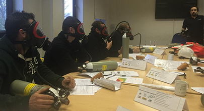
Four members of the Formby Surveys and Geoterra team have completed a two-day confined space entry course to enhance our continually growing range of services. Managing Director, Andy Roberts, Surveyors Jeff Davies and Andy Fellowes from Formby Surveys and our strategic partner and Geoterra Managing Director, Mark Hudson all attended the course to better serve the… Continue reading
20 Jul
2016
How does the C-ALS® laser scanner improve our subsurface scanning services?
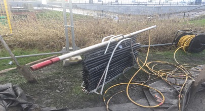
The C-ALS (Cavity Auto-scanning Laser System) is a unique and remarkable specialist surveying instrument that enables the laser scanning of subsurface voids and cavities to be geo-referenced accurately and efficiently. Working at depths in excess of 50m, the C-ALS system can be applied to a multitude of applications in mining, quarrying, civil engineering and building… Continue reading
21 Apr
2016
Formby Surveys’ Scan to BIM Services
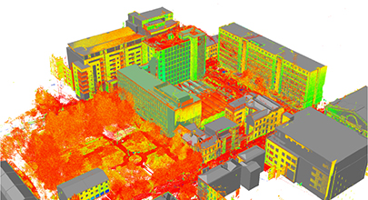
Have you heard about Scan to BIM but aren’t really sure what it involves? Well, read on… Scan to BIM is a workflow which starts with survey-grade as-built 3D laser scan data (collected using a 3D terrestrial or mobile high definition laser scanner) detailing building structures (internal or external), and infrastructure assets. From the resultant… Continue reading
04 Apr
2016
Formby Surveys & Geoterra Form Strategic Partnership
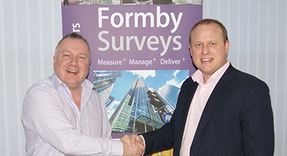
Formby Surveys and Geoterra have formed a strategic partnership with Chartered Land Surveyors and Geospatial Engineers, Geoterra Ltd to enhance our specialist surveying services that we offer to our clients. If you’re not familiar with Geoterra, they are a fully integrated survey solution for land, engineering and architectural projects above ground and below surface including… Continue reading